Prince Edward Island
Prince Edward Island
Canada
NORTH AMERICA
Yes
15
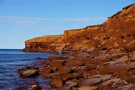
"Canada's Prince Edward Island is an island province. Despite having the highest population density, it is the province with the smallest land area and population. The island is known by a number of titles, including ""Cradle of Confederation,"" ""Garden of the Gulf,"" and ""Birthplace of Confederation.""Charlottetown is its major city and capital. Among the four Atlantic provinces, it is one of the three Maritime provinces. Approximately 10 kilometers (6 miles) from both Nova Scotia and New Brunswick, Prince Edward Island is situated in the Gulf of St. Lawrence. It is roughly 600 kilometers (370 miles) east of Quebec City and 200 kilometers (120 miles) north of Halifax. With a land size of 5,686.03 km2 (2,195.39 sq mi), it is the 23rd largest island in Canada and the 104th largest island in the world [12]. It is the only province in Canada that is made up completely of islands. The island was renamed in 1798 in honor of Prince Edward, Duke of Kent and Strathearn (1767–1820), the fourth son of King George III and the father of the future Queen Victoria in 1819, after it was divided from the British colony of Nova Scotia in 1769. Thus, the title ""Father of the Canadian Crown"" has been applied to Prince Edward. In the Gulf of St. Lawrence, northeast of New Brunswick, north of the Nova Scotia peninsula, and west of Cape Breton Island, sits Prince Edward Island. The Northumberland Strait borders its southern shore. With two urban regions, the island is Canada's most densely populated province overall. The climate of the island is a marine climate considered to be moderate and highly impacted by the neighboring Gulf of St. Lawrence.Because of the Gulf of St. Lawrence's warmer waters, it is typically milder than many parts of New Brunswick and Nova Scotia.The weather is variable throughout the year, and certain weather patterns rarely persist for an extended period of time. As of December 2018, the Province of Prince Edward Island relied entirely on groundwater for its drinking water supply, with about 305 high capacity wells in operation.Groundwater is naturally filtered as it passes through an aquifer. Thirteen wells in three wellfields provide the city of Charlottetown with its water, which is then delivered to consumers. Precipitation replenishes the water that has been removed.
Lake Louise Canada
Lake Louise Canada
Canada
NORTH AMERICA
Yes
13
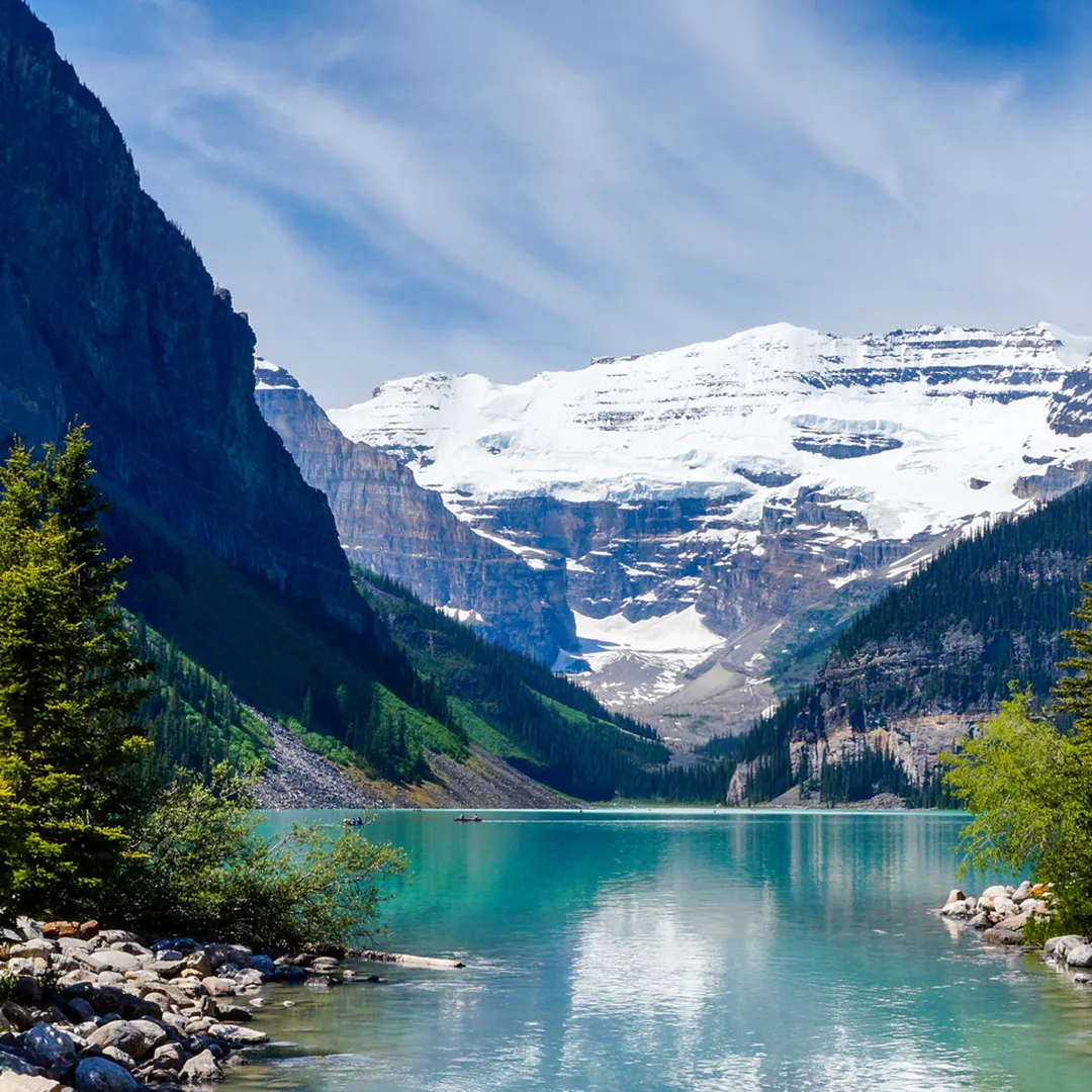
"The Canadian hamlet of Lake Louise is located in Alberta's Banff National Park. Located on the Bow River in Alberta's Rockies, 3 km (1.9 mi) northeast of the lake with the same name, it is named for Princess Louise, Duchess of Argyll. Originally established in 1884 as a Canadian Pacific Railway outpost, Lake Louise is Canada's highest community at 1,600 meters (5,200 feet) above sea level. The climate of Lake Louise is subarctic (Köppen climatic classification Dfc). The average annual snowfall is 279.1 cm (109.9 in), and while winter temperatures can drop below -50 °C (-58 °F), they often hover around -18.4 °C (-1.1 °F) in January and -17.6 °C (-0.3 °F) in February. Summers are characterized by chilly, crisp days and icy mornings. In each month of the year, snowfall is possible. It may also be referred to as a subalpine climate because lower elevations on that latitude have humid continental climates instead. The frost-free period is only 14 days on average due to the high altitude and significant diurnal air temperature change. According to Statistics Canada's 2011 Census of Population, Lake Louise had 691 residents.Workers in the tourism and service sectors frequently relocate to the area for employment, so the population frequently changes from year to year. While Highway 1A starts at the community's entrance, the Trans-Canada Highway (Highway 1) runs alongside the community. Just north of the village is the southernmost point of Highway 93, also known as the Icefields Parkway. The foothills of the Rocky Mountains, including what is now Lake Louise, were inhabited exclusively by local indigenous peoples before European settlers arrived. They hunted the once-common bison, as well as elk, moose, and other big and small game animals, as well as fished the area's abundant waterways and foraged the area's numerous edible and medicinal plant species. The Canadian Pacific Railway (CPR), which would pass through Bow Valley, started construction in the 1870s. The site was named 'Emerald Lake' by CPR worker Tom Wilson, who visited it in 1882 with a Nakoda guide. Afterwards, the hamlet was referred to as ""Holt City,"" ""Laggan,"" and finally, ""Lake Louise."" Although a CPR station from around 1890 was replaced in 1910, the railway company kept using it for other uses until 1976, when it was given to Calgary's Heritage Park Historical Village. The depot was relocated to the park and renovated in the manner of the time when the village was known as Laggan. Because of its excellent preservation and current use as a restaurant, the 1910 station was designated a heritage railway station by the federal government in 1991. Since its 1892 addition to Rocky Mountains Park, Lake Louise has grown to become a popular international tourist attraction thanks to its proximity to the Trans-Canada Highway.

 (1).jpg)
.jpg)
.jpg)