The Grand Canyon USA
The Grand Canyon USA
USA
USA
Yes
25
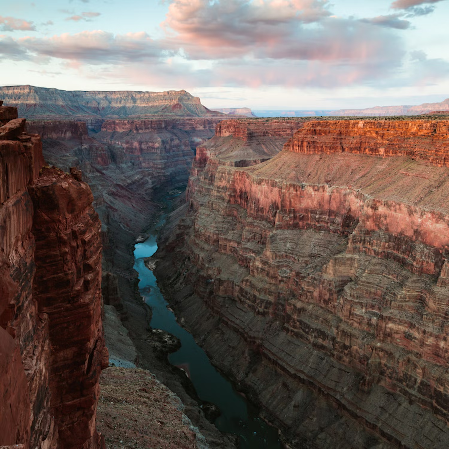
"The Colorado River sculpted the Grand Canyon, a steep-sided canyon in Arizona, USA. The Grand Canyon reaches a depth of more than a mile (6,093 feet or 1,857 meters) and is 277 miles (446 km) long and up to 18 miles (29 km) wide. Grand Canyon National Park, Kaibab National Forest, Grand Canyon–Parashant National Monument, the Hualapai Indian Reservation, the Havasupai Indian Reservation, and the Navajo Nation all contain the canyon and its surrounding rim. President Theodore Roosevelt frequently traveled to the Grand Canyon region to hunt and take in the landscape, and he was a strong advocate for its preservation. Native Americans have lived in the region continuously for thousands of years, establishing settlements inside the canyon and its numerous caverns. The Grand Canyon was a sacred place to the Pueblo people, who visited it on pilgrimage.Arriving from Spain in 1540, García López de Cárdenas is the first European recorded to have seen the Grand Canyon. One of the six separate physiographic regions of the Colorado Plateau province, the Grand Canyon is a river valley in the Colorado Plateau that reveals uplifted Proterozoic and Paleozoic strata.The Grand Canyon is renowned for its breathtaking vastness and its complex and vibrant terrain, while not being the deepest canyon on land in the world (the Kali Gandaki Gorge in Nepal is far deeper). The thick sequence of old rocks that are exposed and well-preserved in the canyon walls makes it noteworthy geologically. Much of the early geologic history of the continent of North America is preserved in these rock layers. The Colorado River basin, which includes the Grand Canyon, formed during the last 70 million years.The geologic origins of the Grand Canyon and the Colorado River have been the subject of data collection, innovative ideas, and often controversial theories by scientists for more than 150 years. A complicated history involving the interaction of numerous geologic events and variables throughout time and in various locations may have contributed to the formation of the Grand Canyon and the Colorado River. The modern-day Four Corners region of the United States was the heart of the Native American society known as the Ancestral Puebloans. They were the earliest known inhabitants of the region surrounding the Grand Canyon. Although the contemporary Puebloan peoples do not favor the term, the cultural group has frequently been referred to as the Anasazi in archaeology.""Anasazi"" means ""enemy ancestors"" or ""alien ancestors"" in Navajo.
Yellowstone US
Yellowstone US
USA
USA
Yes
27
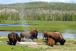
"Located in the northwest corner of Wyoming, with minor areas also extending into Montana and Idaho, is Yellowstone National Park, a U.S. national park. President Ulysses S. Grant signed the Yellowstone National Park Protection Act into law on March 1, 1872, after the 42nd U.S. Congress created it. In addition to being the first national park in the United States, Yellowstone is commonly regarded as the first national park worldwide.The Old Faithful geyser, one of the park's most well-known geothermal attractions, and its fauna are its main draws.Although it encompasses a wide variety of biomes, the subalpine forest is the most prevalent. It belongs to the ecoregion of South Central Rockies forests. Initially, the U.S. Department of the Interior was in charge of managing and overseeing the park; Columbus Delano was the first interior secretary to do so. But in the end, the U.S. Army was given the responsibility of managing Yellowstone for 30 years, from 1886 to 1916.The park was administered by the National Park Service, which had been established the year before, in 1917. More than 1,000 indigenous archaeological sites have been studied by experts, and hundreds of buildings have been constructed and are conserved for their architectural and historical significance. The 3,468.4 sq mi (8,983 km2) Yellowstone National Park is home to mountain ranges, lakes, canyons, and rivers. Part of the Yellowstone Caldera, the continent's greatest super volcano, is covered by Yellowstone Lake, one of the biggest high-elevation lakes in North America. The caldera is regarded as a volcano that is dormant. In the past two million years, it has erupted twice with immense intensity.Because of this continuous volcanism, Yellowstone is home to well over half of the world's geysers and hydrothermal phenomena. The majority of Yellowstone's land area is covered in rocks and lava flows from volcanic eruptions. The park is the centerpiece of the Greater Yellowstone Ecosystem, the biggest remaining almost intact ecosystem in the Earth's northern temperate zone.Yellowstone was designated a UNESCO World Heritage Site in 1978. The Yellowstone River, which gives the park its historical name, roughly divides it in half. The river was given the name Roche Jaune by French trappers near the end of the 18th century, most likely a translation of the Hidatsa name Mi tsi a-da-zi (""Yellow Stone River""). The French name was later translated into English as ""Yellow Stone"" by American trappers. The Native American naming origins for the river is unknown, despite the widespread belief that it was named for the golden rocks found in the Yellowstone Grand Canyon. Native Americans started hunting and fishing in the area at least 11,000 years ago, marking the beginning of the park's human history. The Cook–Folsom–Peterson Expedition of 1869, which included three privately supported explorers, was the first comprehensive trip to the Yellowstone region. The Folsom party arrived at Yellowstone Lake by following the Yellowstone River. In 1870, a group of Montanans organized the Washburn–Langford–Doane Expedition based on the information recorded in the journal kept by the Folsom party members. In addition to Nathaniel P. Langford (after known as ""National Park"" Langford) and a U.S. Army unit led by Lt. Gustavus Doane, it was led by Henry Washburn, the surveyor-general of Montana. The expedition named sites of interest, collected specimens, and explored the area for approximately a month. Eleven years after his initial unsuccessful attempt, Ferdinand V. Hayden was eventually able to explore the area in 1871. He returned to the area with a second, bigger expedition, the Hayden Geological Survey of 1871, which was sponsored by the government. He put up a thorough report that featured paintings by Thomas Moran and large-format photos by William Henry Jackson. The U.S. Congress was persuaded to remove this area from public sale by the report. The Act of Dedication[8], which established Yellowstone National Park, was signed into law by President Ulysses S. Grant on March 1, 1872. By air, the park is 54 miles (87 km) west to east and 63 miles (101 km) north to south. With an area of 2,219,789 acres (8,983 km2; 3,468 sq mi), Yellowstone is bigger than Delaware and Rhode Island combined. Five percent of the land is made up of rivers and lakes, with Yellowstone Lake, at 87,040 acres (352 km2; 136 sq mi), being the greatest body of water. Yellowstone Lake has 110 miles (180 km) of shoreline and a maximum depth of 400 feet (120 m). Yellowstone Lake is North America's largest high-elevation lake, rising 7,733 feet (2,357 meters) above sea level.

 (1).jpg)
.jpg)
.jpg)