Lake Louise Canada
Lake Louise Canada
Canada
NORTH AMERICA
Yes
13
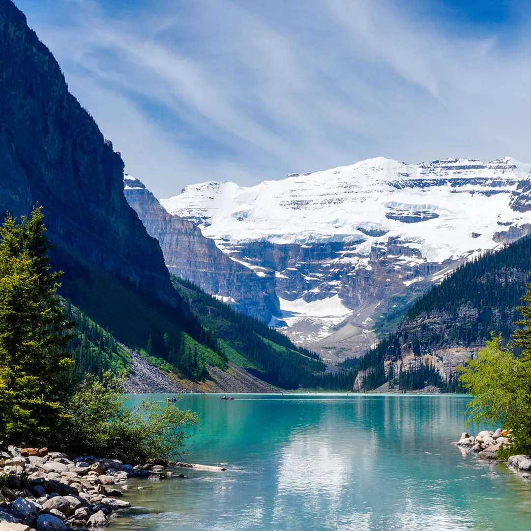
"The Canadian hamlet of Lake Louise is located in Alberta's Banff National Park. Located on the Bow River in Alberta's Rockies, 3 km (1.9 mi) northeast of the lake with the same name, it is named for Princess Louise, Duchess of Argyll. Originally established in 1884 as a Canadian Pacific Railway outpost, Lake Louise is Canada's highest community at 1,600 meters (5,200 feet) above sea level. The climate of Lake Louise is subarctic (Köppen climatic classification Dfc). The average annual snowfall is 279.1 cm (109.9 in), and while winter temperatures can drop below -50 °C (-58 °F), they often hover around -18.4 °C (-1.1 °F) in January and -17.6 °C (-0.3 °F) in February. Summers are characterized by chilly, crisp days and icy mornings. In each month of the year, snowfall is possible. It may also be referred to as a subalpine climate because lower elevations on that latitude have humid continental climates instead. The frost-free period is only 14 days on average due to the high altitude and significant diurnal air temperature change. According to Statistics Canada's 2011 Census of Population, Lake Louise had 691 residents.Workers in the tourism and service sectors frequently relocate to the area for employment, so the population frequently changes from year to year. While Highway 1A starts at the community's entrance, the Trans-Canada Highway (Highway 1) runs alongside the community. Just north of the village is the southernmost point of Highway 93, also known as the Icefields Parkway. The foothills of the Rocky Mountains, including what is now Lake Louise, were inhabited exclusively by local indigenous peoples before European settlers arrived. They hunted the once-common bison, as well as elk, moose, and other big and small game animals, as well as fished the area's abundant waterways and foraged the area's numerous edible and medicinal plant species. The Canadian Pacific Railway (CPR), which would pass through Bow Valley, started construction in the 1870s. The site was named 'Emerald Lake' by CPR worker Tom Wilson, who visited it in 1882 with a Nakoda guide. Afterwards, the hamlet was referred to as ""Holt City,"" ""Laggan,"" and finally, ""Lake Louise."" Although a CPR station from around 1890 was replaced in 1910, the railway company kept using it for other uses until 1976, when it was given to Calgary's Heritage Park Historical Village. The depot was relocated to the park and renovated in the manner of the time when the village was known as Laggan. Because of its excellent preservation and current use as a restaurant, the 1910 station was designated a heritage railway station by the federal government in 1991. Since its 1892 addition to Rocky Mountains Park, Lake Louise has grown to become a popular international tourist attraction thanks to its proximity to the Trans-Canada Highway.
Whistler canada
Whistler canada
Canada
NORTH AMERICA
Yes
17
In British Columbia, Canada's Squamish-Lillooet Regional District sits the resort town of Whistler.About 125 kilometers (78 miles) north of Vancouver and 36 kilometers (22 miles) south of Pemberton, it is situated in the southern Pacific Ranges of the Coast Mountains. In addition to a larger but fluctuating number of seasonal workers, it has a permanent population of about 13,982 (2021). Alpine skiing, snowboarding, and summer mountain biking at Whistler Blackcomb are the main draws for the more than two million visitors to Whistler each year. Since the mid-1990s, prominent ski magazines have ranked Whistler as one of the best places to visit in North America, and its pedestrian village has won multiple design accolades. The majority of the alpine, Nordic, luge, skeleton, and bobsled competitions at the 2010 Winter Olympics were held in Whistler. Approximately 58 kilometers (36 miles) north of Squamish and 125 kilometers (76 miles) from Vancouver, Whistler is situated on British Columbia Highway 99, popularly referred to as the ""Sea to Sky Highway."" Through Pemberton-Mount Currie to Lillooet and connections to the Trans-Canada and Cariboo Highways beyond, the roadway links Whistler to the interior of British Columbia. Only the Rocky Mountaineer, which uses Canadian National Railway tracks from North Vancouver via Whistler and Prince George, offers passenger rail service between Vancouver and Jasper at the Whistler railway station. In the Southside neighborhood, between Nita and Alpha Lakes, lies the station for tour travelers leaving Whistler. The Whistler and Valley Express offers local bus transportation service, including service to Pemberton. The Whistler Shuttle and YVR Skylynx offer a shuttle bus service from the Vancouver Airport and Downtown Vancouver.Situated 140 kilometers (87 miles) to the south, Vancouver International Airport serves as the primary international airport for both residents and visitors to Whistler. Whistler's public schools are run by the School District 48 Sea to Sky. Myrtle Phillip Elementary and Spring Creek Elementary are the two elementary schools. Whistler Secondary School is the only high school in the neighborhood. La Passerelle is the only Francophone primary school run by the Conseil scolaire francophone de la Colombie-Britannique in that city. In the summer, Whistler is renowned for its mountain biking and hiking, and in the winter, for its skiing and snowboarding. Cross-country skiing, skate skiing, ice skating, snowshoeing, backcountry skiing, telemark skiing, and tobogganing are some of the other winter sports that people in Whistler love. Golfing, fishing, trail jogging, mountain biking, outdoor yoga, and hiking are among the popular summertime activities in Whistler. The four run difficulties for skiing, which is undoubtedly Whistler's major draw, are green (circle), blue (square), black (diamond), and double black (diamond). The difficulty of each run remains constant throughout the year. ""Expert only"" markers at the bottom of several chairlifts indicate that the majority of the runs available from that chair are black diamonds or double black diamonds, and there are numerous signs around the mountain that indicate the severity of the runs.
.jpg)

 (1).jpg)
.jpg)
.jpg)